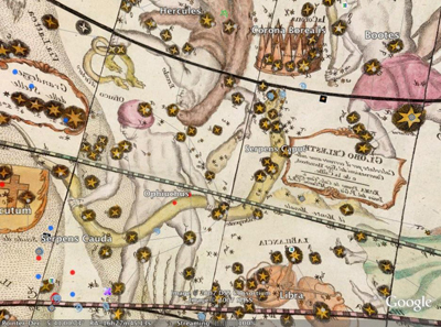
 On Wednesday, at the American Astronomical Society meeting in Austin, Texas, Google engineering director Andrew Moore introduced a new version of the company’s Sky application in Google Earth.
Of particular interest to me is the inclusion of historical star maps from the ginormous collection of David Rumsey at Cartographic Associates. He’s amassed some 150,000 maps of Earth and sky. Google Earth added the first terrestrial maps November 2006.
Now, Google Sky adds historical sky maps dating back to 1792. By turning on different layers, you can immediately compare views of the same sky region in different maps. There’s even an “Art layer” built from Johannes Hevelius’ beautiful 1690 constellation engravings.
Some historical cartographers drew their maps as if the constellations were viewed from the outside of the celestial sphere. In Google Sky, the labels on those original maps appear backward because the application is viewing them from the inside — that is, the way we actually see them.
More significantly, Google has also released the Sky Application Programming Interface (API). This is a set of tools for passing data to Google Sky so developers can make their own “mashups” using its data. Here’s one example, and here’s another for the iPhone.
Have you found other astronomy-related mashups? Tell us about them!